UAV Zones - Drone and UAV no-fly zone maps 4.1
Free Version
Publisher Description
Why charge 0.99$, we are developing new app and we need some income to continue on this development. App was free for 4 years. And it is going to be free with new update.
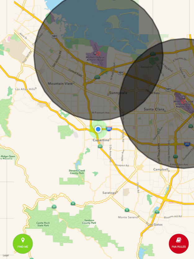
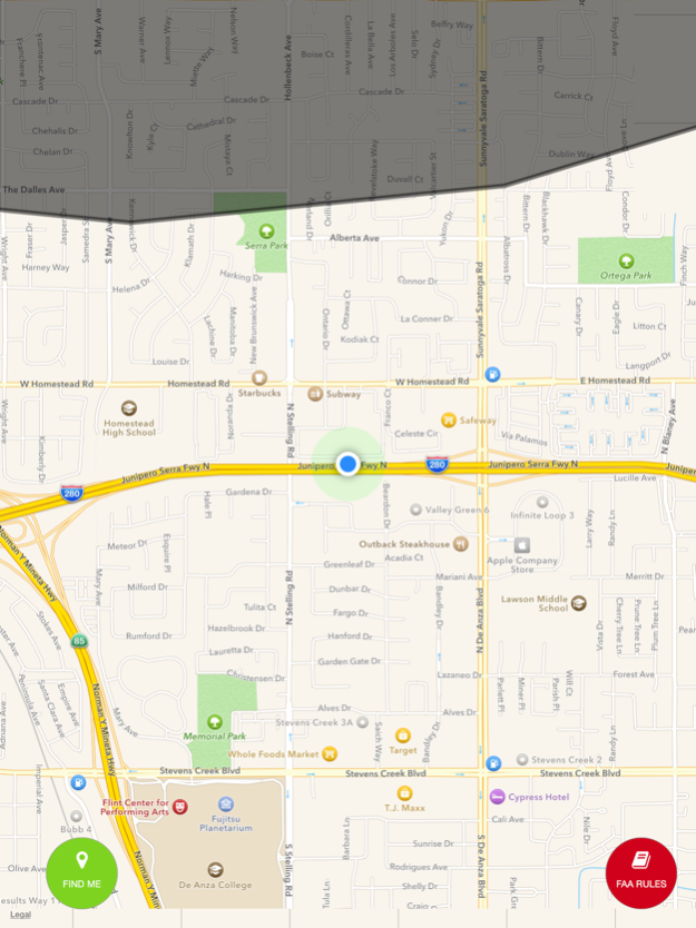
UAV Zones display most of the no-fly zones for the drones. It is based on no fly zone maps. Black polygons are represent no fly zones .
Please send us any feature request for the app.
FEATURES
- Added new airport , heliport and other type of flying object landing places
- You be able to search
- Just move map to location that you want to see and tap "Search Here"
- Added weather screen, it will show current or selected areas weather information.
- No Fly Zone Maps cover most of the US Airports, National Parks, Military bases.
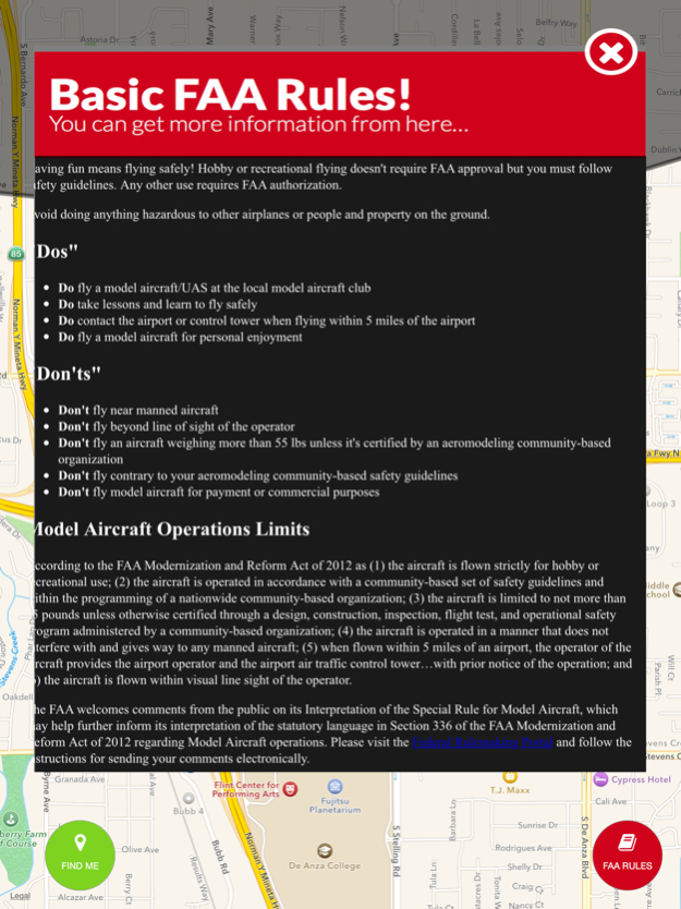
Disclaimer: We do not assume responsibility for the accuracy of the data represented in this app for the NO FLY ZONE restrictions. Please also check with FAA to make sure you can fly your UAV. If you like to do any commercial flights, please contact closest FAA bureau from 1-866-835-5322 and get a clearance. The data is gathered from public APIs.
Oct 11, 2016
Version 4.1
This app has been updated by Apple to display the Apple Watch app icon.
- Added new airport , heliport and other type of flying object landing places
- You be able to search
- Just move map to location that you want to see and tap "Search Here"
- Added weather screen, it will show current or selected areas weather information.
- Map search for rest of the world
- Wind speed on map
Please let us know changes you wanted.
About UAV Zones - Drone and UAV no-fly zone maps
UAV Zones - Drone and UAV no-fly zone maps is a free app for iOS published in the Recreation list of apps, part of Home & Hobby.
The company that develops UAV Zones - Drone and UAV no-fly zone maps is Engin Ates. The latest version released by its developer is 4.1.
To install UAV Zones - Drone and UAV no-fly zone maps on your iOS device, just click the green Continue To App button above to start the installation process. The app is listed on our website since 2016-10-11 and was downloaded 3 times. We have already checked if the download link is safe, however for your own protection we recommend that you scan the downloaded app with your antivirus. Your antivirus may detect the UAV Zones - Drone and UAV no-fly zone maps as malware if the download link is broken.
How to install UAV Zones - Drone and UAV no-fly zone maps on your iOS device:
- Click on the Continue To App button on our website. This will redirect you to the App Store.
- Once the UAV Zones - Drone and UAV no-fly zone maps is shown in the iTunes listing of your iOS device, you can start its download and installation. Tap on the GET button to the right of the app to start downloading it.
- If you are not logged-in the iOS appstore app, you'll be prompted for your your Apple ID and/or password.
- After UAV Zones - Drone and UAV no-fly zone maps is downloaded, you'll see an INSTALL button to the right. Tap on it to start the actual installation of the iOS app.
- Once installation is finished you can tap on the OPEN button to start it. Its icon will also be added to your device home screen.
